Prints of maps, plans & city views
Historical insights: to give away or keep for yourself
The city archive has scanned for you a small assortment of old maps, city plans and city views. You can purchase photo prints of these. The production costs 5,00 € per reproduction.
In a stylish picture frame, these make a nice gift - perhaps for your best friends or for yourself?
Maps
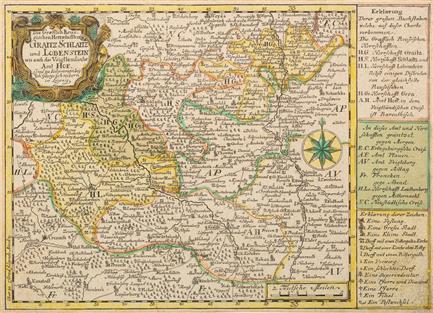
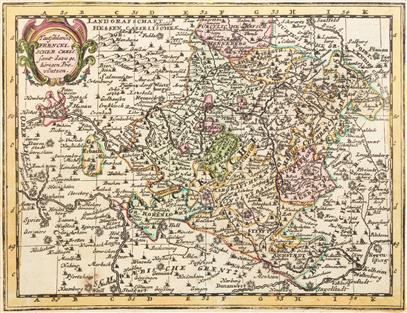
Die graefflich Reussischen Herrschaften Graitz, Schlaitz und Lobenstein wie auch das vogtländische Amt Hof, nach 1749 (Signatur KK 72).
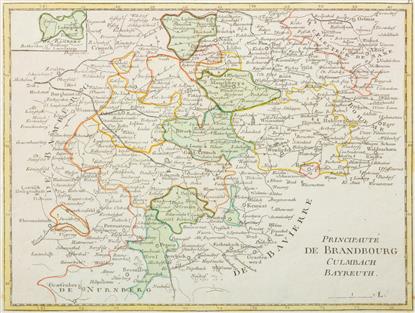
Principauté de Brandbourg-Culmbach-Bayreuth, secondary map of Ludwigstadt, 1759 (call number KK 74).
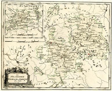
The Principality of Kulmbach or Bayreuth (Nro. 213), drawing of postal routes, secondary map Neustadt/Aisch, 1791 (call number KK 76).
Mappa Stadt Nürnberg, Frais und Wildbahn, 1717 (shelfmark KK 100).
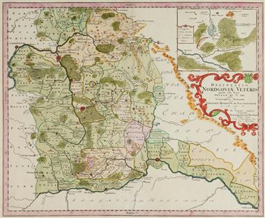
Delineatio Nordgoviae Veteris, contains: approximately the area of Bavaria between the Danube and Thuringia, 1733 (shelfmark KK 103).
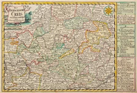
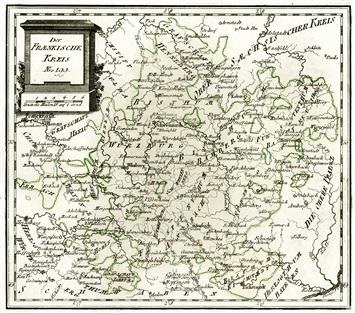
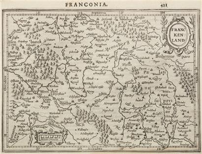
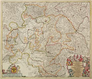
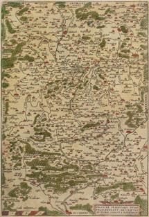
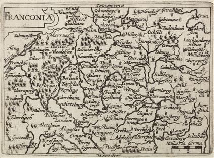
The fraenckische Creis, before 1750 (call number KK 105)

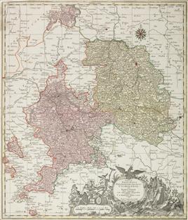
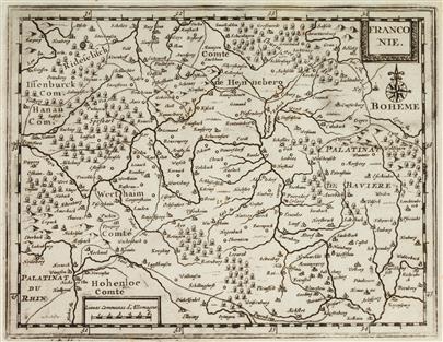
Circulus Franconicus in quo continentur Episcopat . Würtzburgensis, Bambergensis et Auchstadiensis, after 1756 (call number KK 106)
Circulus Franconicus in quo sunt Episcopatus Würtzburg, Bamberg et Aichstet, c. 1700 (shelfmark KK 107).
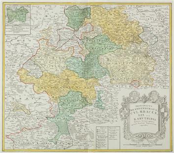
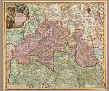
Tabulae Principatus Brandenburgico-Culmbacensis sive Baruthini. Pars Superior cum adjacentibus Regionibus, after 1757 (shelfmark KK 476).
Principatus Brandenburgico-Culmbacensis vel Baruthinus (northern part), before 1753 (shelfmark KK 542).
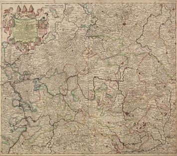
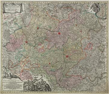
Oberer und Groster Teil des gantzen Hochöbl. Fränckischen Craisses, copperplate engraving with border and delicate surface color, c. 1720 (signature KK 566)
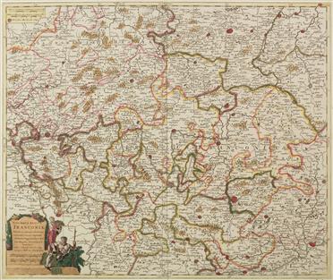
Der Fränkische Kreis, copper engraved map (Nro. 199), 1791 (call number KK 569).
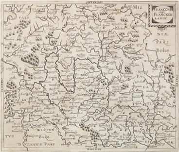
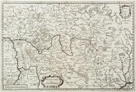
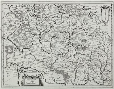
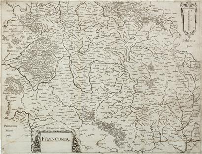
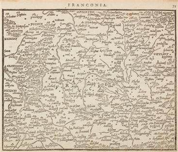
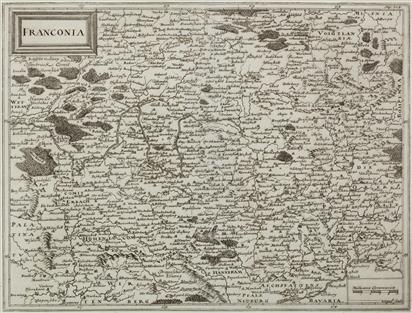
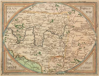
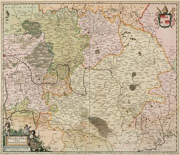
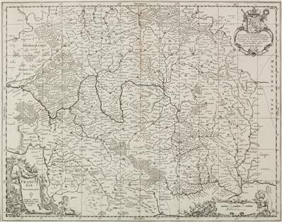
Franconia vulgo Franckenlandt, 1627 (call number KK 614)
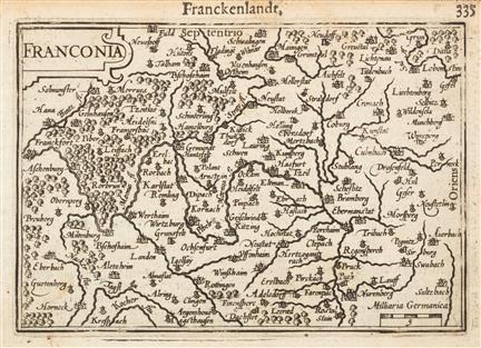
Franckenlandt. Francia orientalis, 1627 (call number KK 615).
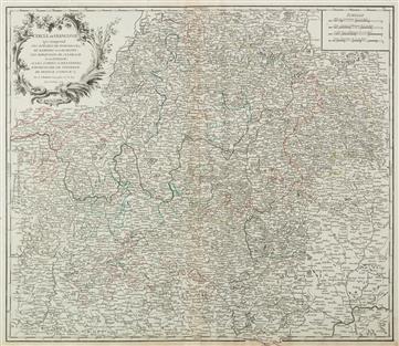
Cercle de Franconie, with old border color, 1752 (KK 616)

Franconia from the work "Epitome Theatri Oreliani" by Abraham Ortelius, 1602 (call number KK 619)
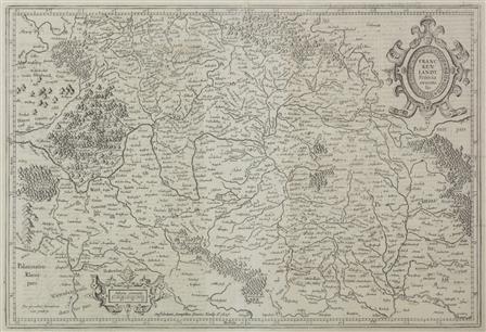
Franconia. Franckenland, 1607 (call number KK 620)
Circulus Franconicus, old border and area coloring, contains: Subsidiary map of the county of Erbach in the Odenwald, c. 1740 (call number KK 623).
Nova atque exacta Franconiae Tabula, alter Grenzkolorit, c. 1710 (call number KK 624).
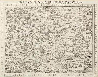
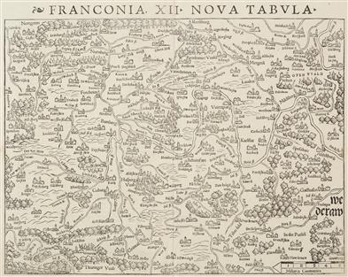
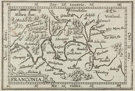
Franconia XIII Nova Tabula, Geographia Universalis gesüdet (court not included), 1552 (call number KK 626).
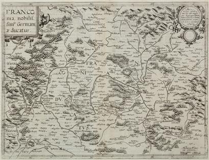
Franconia, nobillisimus Germaniae ducatus, 1593 (call number KK 627)
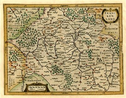
Franckenland,old colored, 1630 (signature KK 629)
Circulus Franconicus, in quo sunt Episcopatus Wurtzburg, Bamberg et Aichstet, c. 1680 (shelfmark KK 637).

Circulus Franconicus, old surface color, 1757 (call number KK 641)

Franconiae Nova Descriptio, after 1641 (shelfmark KK 643).
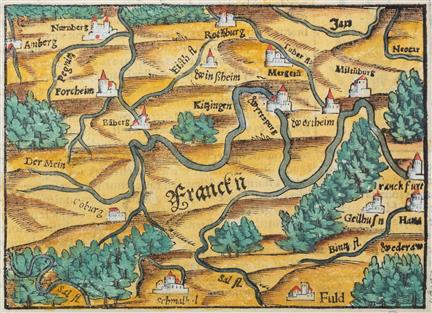
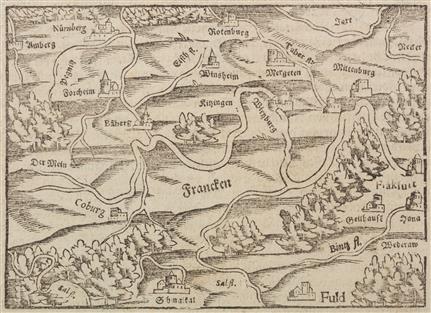
Francknn From the "Cosmographey" of Sebastian Münster, ca. 1550 (Signature KK 644)
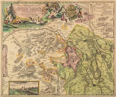
Grafschaft Giech, old colored. View of Thurnau, contains: showing the entire Franconian Jura and Franconian Forest, 1707-1712 (call number KK 645).
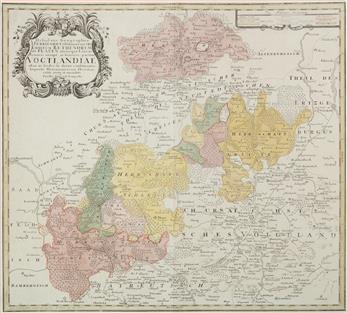
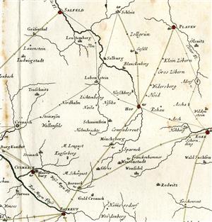
Vogtlandiae, improved version by Paul Daniel Longolius, ca. 1770 (call number KK 647)
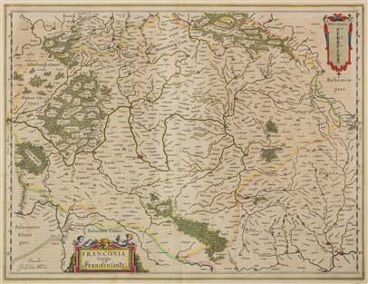
Franconia vulgo Franckenlandt, with old border and (partly) area color, after 1635 (call number KK 649).
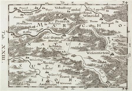
Marchionatus Superior, contains: southern part of the Fichtelgebirge, plate XXIII of the 64 part map of Franconia "Franconiae Mappa Locupletissima", 1692 (call number KK 655)
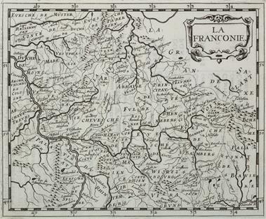
La Franconie, 1644 (call number KK 656)
Franconia vulgo Franckenlandt, 1633 (call number KK 657)
Franconia, 1598 (call number KK 684)
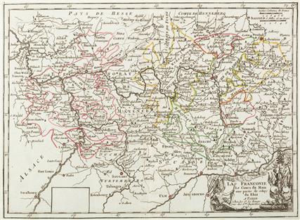
La Franconie, Le Cours du Main, une partie de celuy du Rhin, 1743 (call number KK 687).

Cercle de Franconie, 1714 (call number KK 689).
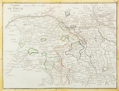
Comté de Giech en Franconie, Alter Grenzkolorit, 1743 (call number KK 690).
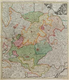
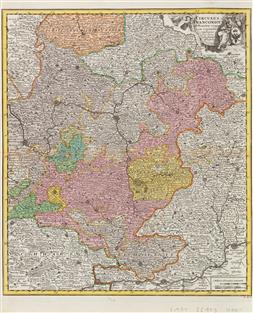
Tabulae Geographicae Principatus Brandenburgico-Culmbacensis Sive Baruthini Pars Inferior cum adjacentibus Regionibus, 1733-1740 (call number KK 694).
Frankonia XII Nova Tabula, 1540 (call number KK 695)
Circulus Franconicus ad Orientem vergens, 1718 (shelfmark KK 696).
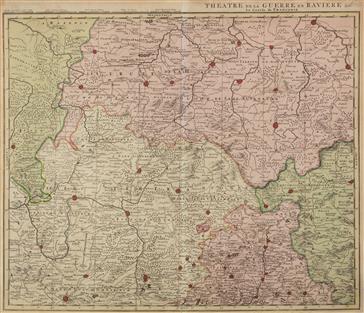
Theatre de la Guerre en Baviere et c: Le Cercle de Franconie, c. 1750 (call number KK 698)
Franconia, 1672 (call number KK 700)
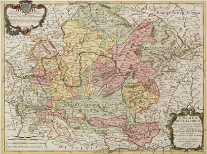
Circolo di Franconia, 1690 (call number KK 703)
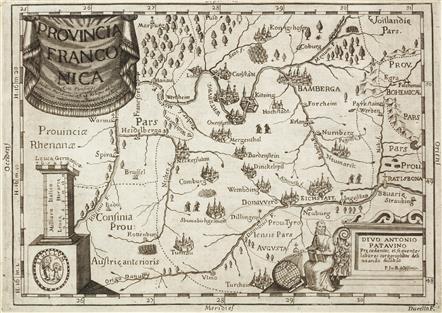
Provincia Franconica, c. 1700 (call number KK 704).
Franconia, 1578 (call number KK 705)
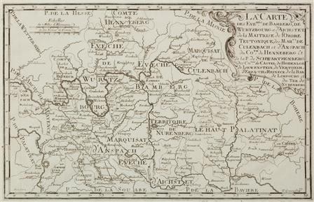
La Carte des Evechés de Bamberg, de Wurtzburg et d'Aichstet ..., 1694 (call number KK 706).
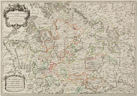
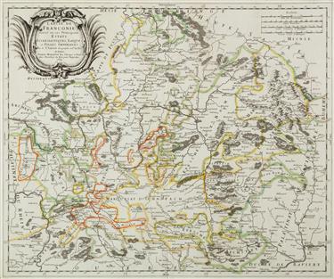
Le Cercle de Franconie subdivisé en tous les Estats qui le composenta, 1703 (call number KK 707).
Cercle de Franconie divisé en ses Principaux Estats ..., 1669 (call number KK 709).
Franconia, 1686 (call number KK 711)

Francken, from the author's Cosmography, c. 1590 (call number KK 728).
Francken, caption: "Franckenlandt in Germania", 1598 (call number KK 732)
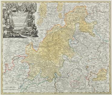
Sac. Rom. Imperii Principatus et Episcopatus Bambergensis Nova Tabula Geographica, NK: Besitzungen d. Stiftes Bamberg in Kärnten, Ansicht d. Stadt Bamberg, ca. 1720 (Signatur KK 733).
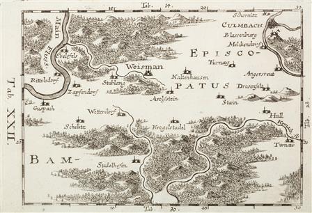
Plate XXII of the 64-part map "Franconiae Mappa Locupletissima", contains: Franconian Forest south and west of Kulmbach, 1692 (call number KK 735).
Cours de Postes dans la Franconie par Bamberg, Baireut et jusqu' á Eger, II. fol., 1759 (detail Northeast Upper Franconia) (call number KK 740).
Franconie, contains: from the atlas "L'Atlas Soulagé de son gros + pesant fardeu ..., 1712 (call number KK 745).

Charte von Franken u.s.f. which refers to Gustav Adolph's life, 1760 (shelfmark KK 747).
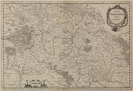
Totius Franconiae Nova Descriptio, 1638 (shelfmark KK 748).

Partie Orientale du Cercle de Franconie, old border color, c. 1740 (call number KK 751).

Theatre de la guerre presente en Allemagne, 1758 (call number KK 767).
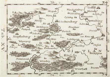
Plate XV of the 64-part "Franconiae Mappa Locupletissima", contains: Area between Hof and Kupferberg, 1692 (call number KK 769).
Teutschlandes Fraenckischer Creis samt dazugehörigen Provintzen, surface color, 1723 (call number KK 800)
Itinerarium Orbis Christiani, contains: Frankfurt/M.-Münchberg, Weißenstadt; Schmalkalden-Gunzenhausen, c. 1580 (call number KK 803).
Franciae orientalis (vulgo Franckenlant) descriptio Sebastian von Rotenhan, contains: Weidenberg-Seligenstadt; Schmalkalden-Rothenburg o.d. Tauber, 1572 (shelfmark KK 804).
Franconia vulgo Franckenlandt, area color, contains: Frankfurt/M.-Eger; Schmalkalden-Ingolstadt, 1662 (call number KK 805).
Franconiae nova descriptio, with printed coordinate lines, 1681 (call number KK 806).

Bohemia oder das Konigreich Bohmen mitt angretzten Ländter, enthält: von Hof bis Budweis, von Amberg bis Glatz, 1627 (shelfmark KK 810).
Franconia, 1604 (call number KK 1093)
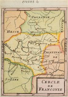
Cercle de Franconie, 1683 (call number KK 1094)