Redevelopment areas
A redevelopment area is a clearly defined area in which the city of Hof wishes to carry out a so-called "urban redevelopment measure". To this end, the city of Hof adopts a formal redevelopment statute in accordance with Section 142 of the German Building Code (BauGB).
A redevelopment area is defined if redevelopment is necessary in an area of the city and is in the public interest. The necessity is proven by means of a preparatory study. This records urban development, structural and social conditions as well as interrelationships and, above all, grievances at the time of the investigations.
In addition to the city's measures in the public sphere, from which the entire redevelopment area will benefit, modernization and repair of buildings as well as construction and reorganization measures for the reuse of land can be promoted in the private sphere. All these measures contribute to achieving the goals of the overall measure.
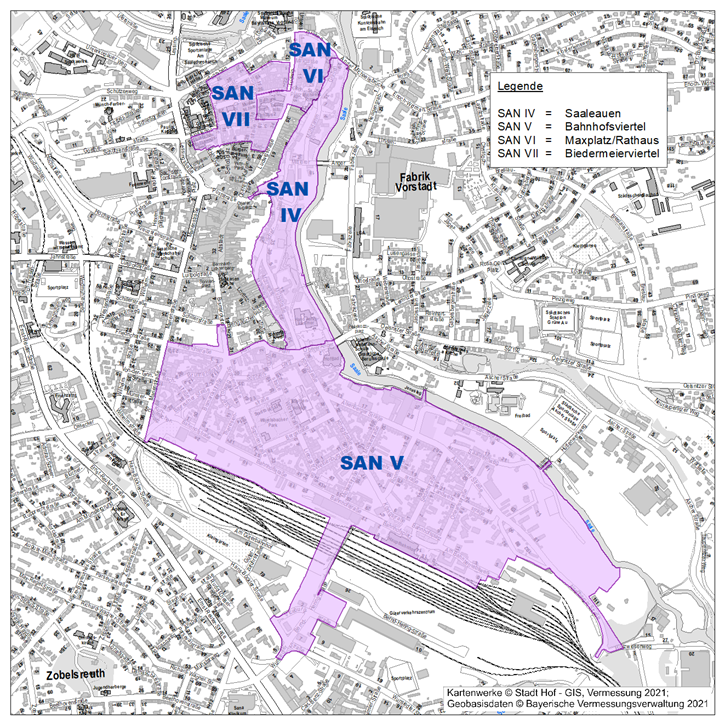
Overview of all redevelopment areas
There are currently 4 redevelopment areas in the city of Hof:
- Redevelopment area IV - Saaleauen
- Redevelopment area V - Bahnhofsviertel
- Redevelopment area VI - Maxplatz/city hall
- Redevelopment area VII - Biedermeier quarter
The redevelopment areas 1 to 3 were cancelled in December 2021. Details can be found here.
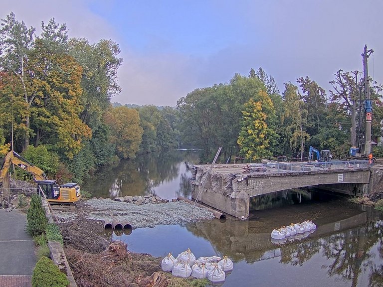
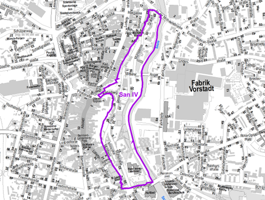
Redevelopment area IV
Saaleauen
The redevelopment area of approximately 11.7 ha is comprised of:
| to the north: | from the Michaelis Bridge |
| in the east: | from the river Saale |
| in the south: | from the Oberer Anger and the Pfarr |
| in the west: | from the Mühlberg, from properties west of the Fischergasse, the Rähmberg, from the Graben |
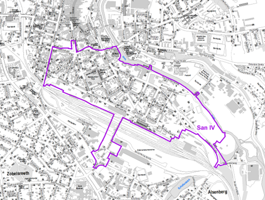
Redevelopment area V
Railroad Station Quarter
The redevelopment area of approximately 73.5 ha is comprised of:
| to the north: | From the Friedrichstraße, the Pfarr, the Oberen Anger and the Saale; |
| to the east: | by the Saale and Alsenberger Strasse; |
| to the south: | from the railroad station area with tracks including the aerial footbridge; |
| to the west: | From Kurt-Schumacher-Platz and Marienstraße. |
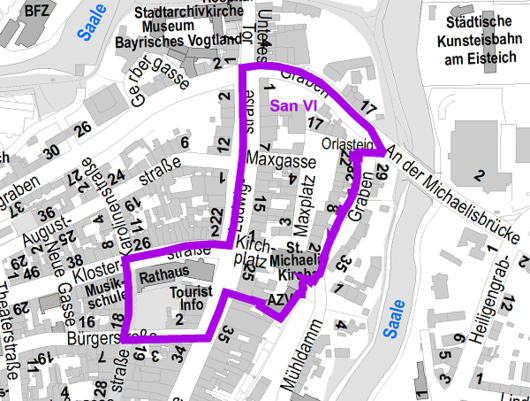
Redevelopment area VI
Maxplatz/City Hall
The redevelopment area of approximately 3.7 ha is comprised of:
| to the north: | From the Klosterstraße or the ditch; |
| to the east | from the ditch; |
| in the south: | Line south of Kirchplatz 1 and Ludwigstr. 27, from Bürgerstraße; |
| in the west: | from Karolinenstrasse and Ludwigstrasse, respectively. |
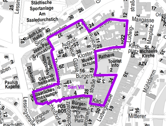
Redevelopment area VII
Biedermeier quarter
Redevelopment area VII - Biedermeier quarter
The approx. 5.7 ha redevelopment area comprises
| in the north: | by the Klostertor, Sigmundsgraben and Auguststraße; |
| to the east: | by Ludwigstraße and Karolinenstraße; |
| in the south: | from Schloßgasse and Karlstraße; and; |
| to the west: | from Theaterstraße and Lessingstraße. |
The summary of the analysis results of the preparatory studies for the designation of the Biedermeierviertel redevelopment area can be found here.