Surveying and geoinformation systems

The GIS, Surveying department consists of 5 employees. Currently, the department manages more than 30 thematic cadastres and makes them available to the employees of the city administration via intranet. These are spatial data from the sewer cadastre to the street cadastre and statistical districts. The thematic cadastres form the basis for any planning in building construction or civil engineering. Furthermore, the department is responsible for all surveying necessary in the city administration. These include work in connection with new construction or renovation measures, but also sovereign controls as well as surveys for urban land use planning procedures and updating of thematic cadastres.

Surveying tasks

Here we take measurements

  • Surveys for the maintenance of the thematic cadastre
  • Boundary staking (no official cadastral survey) during the construction phase of objects
  • Staking out of axes
  • Topographic surveys
  • Precision surveys for the urban position and height fixed point field
  • Deformation surveys
  • Terrain surveys as a basis for planning of all kinds
  • Creation of digital terrain models
  • Building code inspections for new buildings
Order site plan for building application

Card systems

The city of Hof recorded in detail

  • Cadastre of old waste disposal sites
  • Tree cadastre
  • Development plans
  • Biotope register
  • Monument register
  • Land use plan
  • Land use planning cadastre
  • Water cadastre
  • Green area cadastre
  • Contour line cadastre
  • Canal cadastre
  • Map sheet sections
  • Small-scale classification
  • Climatopes
  • Landscape protection areas
  • Empty pipe cadastre
  • Aerial photographs
  • Nature conservation area cadastre
  • Cycle path register
  • Standard value map
  • Redevelopment areas
  • School district
  • Sink cadastre
  • City base map
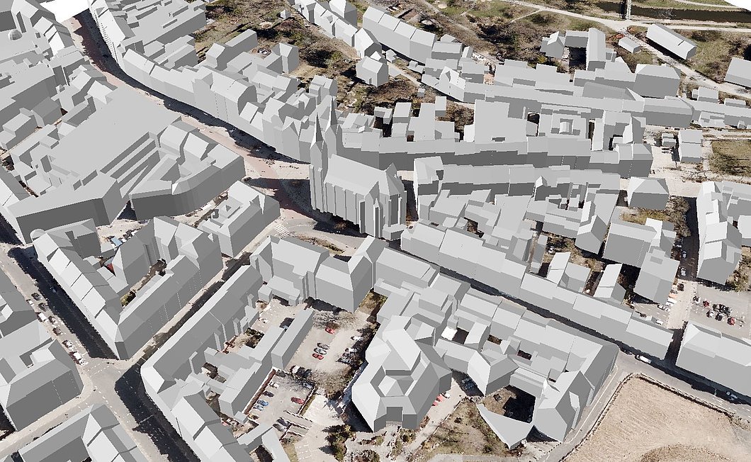
  • City model
  • City map
  • Street axes
  • Street lighting
  • Street cadastre
  • Flood plains
  • Water protection areas

City map

"Hof in Bavaria at the top" at a glance

The interactive map of Hof will open in a new window. If you are using a pop-up blocker in your browser, you may have to confirm the opening of the window manually. If the window with the city map still does not open, you can get to the

Display of the city map

News

For 30 years, the Saale Cycle Route has connected the three federal states of Bavaria, Thuringia and Saxony-Anhalt.

Auf diesem Foto ist ein Online-Beratungstermin zu sehen

As part of the Start-up Consulting Day on May 14, 2024, free online appointments for consultations will again be offered.

Mehrere Dutzend Menschen in einem großen Saal hören einem Redner zu.

The traveling exhibition of the Bavarian Chamber of Architects at the VHS Hofer Land shows how energy-efficient and sustainable building works until…

The historic Bismarck Tower in Hof is facing an urgently needed renovation after years of being inaccessible to the public due to structural defects.

Auf diesem Foto sind geparkte Autos zu sehen

At its most recent meeting, the city council approved changes to the parking fee regulations.

Auf diesem Foto ist ein Jazz-Straßenkonzert zu sehen

The InnenHof concerts take place every Thursday from May to September from 7 to 9 pm with free admission.

New life in old walls: From May 3 to 19, the Renovation Days 2024 will showcase successful examples and provide valuable practical tips.


The city of Hof's heat planning is expected to be completed in March 2025.

Touring exhibition "Exemplary buildings" at the VHS Hofer Land

Together, the winning teams covered almost 50,000 kilometers, which is equivalent to more than one trip around the world.

Muehlbauer Ute

Ute Mühlbauer

Department of urban planning

Karolinenstraße 17

95028 Hof

09281 815 1518